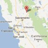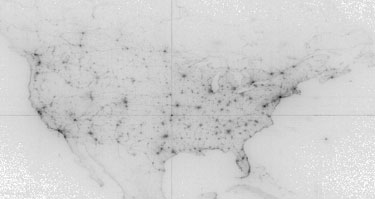
Ken and I have bought a house in Grass Valley, CA, off Ridge Road near Slate Creek. We’re not leaving San Francisco, we’re keeping two houses, but we expect to be spending a whole lot of time up at the new place. It’s a big house with plenty of room for guests; if you know me, you’re welcome to come visit! Why Grass Valley? Ken and I have talked about a country house for a few years now, far enough away to feel like we were getting out of SF but still within driving distance. We also wanted something in the Sierra foothills and with a good GA airport; that quickly narrowed it down to around Grass Valley. It helps that both Grass Valley and Nevada City next door are relatively big with good restaurants, grocery stores, etc. It’s a pretty sophisticated place for rural California. And life’s good in the country. It’s warm in summer and cool but not too snowy in winter. There’s deer. And friendly neighbors. Not terribly expensive, we were able to find a very nice house with a lot of space and privacy. It’s pretty great, really all that’s missing is the vibrancy and opportunity of a big city. I’ve quickly come to appreciate the beauty and relaxed life in the country. My hope is by spending some time away from San Francisco I’ll appreciate what the city has to offer all the more.  Here is the first map I ever published online, a visualization of what locations people were looking at on Google Maps on April 6, 2005. This was right after Google Maps added satellite imagery. Here's the official blog post about the visualization; the published image is gone, good thing archive.org has it. I wince to see the ugly stretched projection; I didn't know anything about maps, so I just plotted longitude and latitude as X/Y axes. (Cartographers call this Plate Carrée; it's generally a sign the mapper is clueless.) The greyscale histogram is not particularly good, although in my defense the original unscaled PNG was nicer. I think the whole thing started as a fun project to learn Sawzall, Google's 20% time in action. |
||
